USDA’s Conservation Effects Assessment Project (CEAP) is a multi-agency effort led by the Natural Resources Conservation Service (NRCS) to quantify the effects of conservation practices across the nation’s working lands.
About the Conservation Effects Assessment Project
Through CEAP, USDA quantifies and reports on trends in conservation practices, and associated outcomes, over time. CEAP findings are used to guide conservation program development and support conservationists, agricultural producers, and partners in choosing the most effective conservation actions and making informed management decisions backed by data and science.
CEAP assessments are carried out at national, regional, and watershed scales for conservation efforts related to cropland, grazing land, wetlands, and wildlife.
Conservation Effects Assessment Project Assessments
CEAP provides assessments and associated conservation outcome insights for multiple land uses and conservation goals. These assessments empower a diversity of customers to evaluate conservation successes, identify potential improvements, and set targeted, measurable goals for the future.
You may access CEAP assessments for the following areas of focus. Click on each for additional information.
Conservation Effects Assessment Project Highlights
The below blogs, fact sheets, reports, and webinars represent recent resources and key findings released by CEAP. Visit this webpage frequently to see what's new, or browse by the above focus areas to find specific content for a given conservation scope.
Conservation Practices on Cultivated Cropland: A Comparison of CEAP I and CEAP II Survey Data and Modeling
NRCS published results from the latest national CEAP cropland assessment in March 2022. This report provides data on national and regional trends in cropland conservation, and associated effects, over time.
Three Key Findings from First-of-its-Kind Study on NRCS Conservation Practices and U.S. Pollinators
CEAP and Virginia Tech collaborated on a first-of-its-kind study to evaluate the impacts of NRCS’s voluntary conservation practices on pollinator habitat nationwide. This blog shares three key findings to inform data-driven decision making for U.S. pollinator conservation.

Can Agriculture Improve Water Quality? With Data-Driven Voluntary Conservation, the Answer is Yes.
This blog by Chief Terry Cosby details some of the key ways USDA's Natural Resources Conservation Service supports producers and conservation partners in improving water quality and strengthening agricultural operations through voluntary conservation.

Mapping Riverscapes to Support Productive and Resilient Working Lands
This Conservation Outcomes Webinar highlights how to identify and map key riverscapes to help maximize the benefits of riparian wetlands and support productive working lands. Presenters are Dr. Joe Wheaton, Utah State University, and Jeremy Maestas, NRCS.

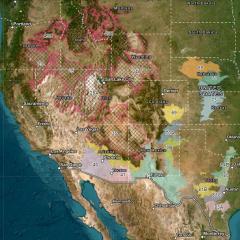
Rangeland Brush Estimation Tool (RaBET)
RaBET is an interactive, map-based tool developed by CEAP Grazing Lands to support rangeland conservation. This tool may be used by ranchers and other land managers to estimate woody plant canopy cover and assess woody encroachment on western rangelands.
Conservation Outcomes Email Updates
You may subscribe to receive emails with updates from the Conservation Effects Assessment Project. Enter your email address here, then select the "Conservation Outcomes" topic under Conservation.
Additional Resources
Publications | Conservation Effects Assessment Project
USDA’s Conservation Effects Assessment Project, CEAP, provides a suite of publications highlighting the effects of voluntary conservation across the nation’s working lands.
Learn MoreConservation Assessment and Planning Tools
USDA’s Conservation Effects Assessment Project (CEAP) collaborates with partners to deliver tools that support conservation assessment and planning for diverse land uses and management goals.
Learn MoreFrequently Asked Questions | Conservation Effects Assessment Project
This webpage provides answers to frequently asked questions about the Conservation Effects Assessment Project (CEAP).
Last Updated: June 9, 2023
Learn MoreConservation Outcomes Webinar Series
The Conservation Outcomes Webinar Series provides key findings, data, and tools to support producers and partners in pursuing voluntary conservation efforts across the nation's working lands.
Learn MoreContacts
| Name | Position | Phone Number | |
|---|---|---|---|
|
Evelyn Steglich
|
Acting Modeling Team Lead and Cropland Lead, Conservation Effects Assessment Project
|
||
|
Carrie-Ann Houdeshell
|
Grazing Land Lead, Conservation Effects Assessment Project
|
||
|
Joe Prenger
|
Wetland Lead, Conservation Effects Assessment Project
|
||
|
Charlie Rewa
|
Wildlife Lead, Conservation Effects Assessment Project
|
||
|
Lisa Duriancik
|
Watershed Lead, Conservation Effects Assessment Project
|
Natural Resources Assessment
NRCS documents the effects of conservation practices and systems so that better decisions can be made and risk is managed more effectively. NRCS cooperates with other Federal and State agencies and conservation partners to collect and analyze natural resource data.